

MIAMI (AP) — Nolo has changed from a strong hurricane to a typhoon after it crossed the international date line.
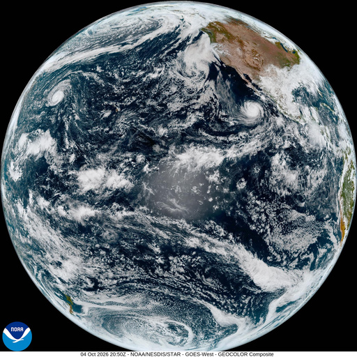
Nolo was a Category 3 hurricane with maximum sustained winds of 115 mph (185 kph) Sunday morning Hawaii time before it crossed the agreed-upon line in the Pacific Ocean that separates one day from the next. Names of tropical cyclones vary by the parts of the world where they occur.
Monday morning Japan time, Typhoon Nolo had maximum sustained winds of 100 mph (162 kph) and was moving west at 19 mph (30 kph), according to the Japan Meteorological Agency.
“The good news is there’s a large, vast ocean, so even though it is still going to be strong, it’s not near any land,” said John Cangialosi, a senior hurricane specialist with the U.S. National Hurricane Center in Miami.
Tropical cyclones with winds over 74 mph (119 kph) are called hurricanes in the northern Atlantic Ocean and the central and eastern Pacific. They are typhoons in the North Pacific, while the South Pacific and Indian Ocean use just the generic term tropical cyclone no matter the strength of the storm.
Nolo is forecast to keep moving west and gradually weaken.
Nolo skirted Hawaii as a hurricane a week ago. It then lost some of its punch and became a tropical storm, before regaining hurricane strength on Friday.
Elsewhere in the Pacific, Hurricane Rachel continued heading westward on a path away from Mexico.
As the storm moved further out to sea, it was sending dangerous waves and swells back to the coast of west-central Mexico and the Baja California Peninsula, according to the hurricane center.