By FOX23.com News Staff
TULSA COUNTY, Okla. — Tulsa County and the City of Tulsa have activated their Emergency Operations Center to monitor flooding conditions throughout the county as multiple rounds of heavy rainfall continue to impact the area.
The Emergency Operations Center will be coordinating with law enforcement, emergency managers and the Oklahoma Department of Emergency Management to actively monitor and respond to changing weather conditions.
With the National Weather Service reporting expected rainfall through Friday, low-lying areas and places already experiencing flooding from previous rainfall are at an increased risk due to saturated soil, elevated creek levels and ongoing runoff.
Officials said they’re closely monitoring the areas near Bird Creek, Caney River, Pole Cat Creek, Coal Creek, Haikey Creek and Snake Creek as rainfall continues.
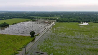
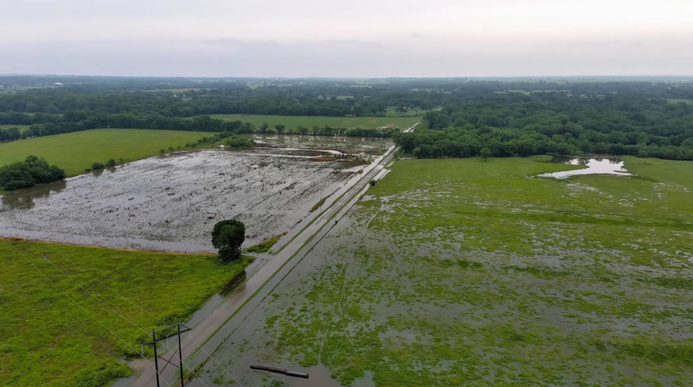
Officials are warning Tulsa County residents and drivers about roads that have already experienced flooding.
Flooded areas include:
- Peoria Avenue from 176th Street North to 186th Street North
- 176th Street North and Memorial Drive
- 7000 East 86th Street North
- 186th Street North between Peoria Avenue and Garrison Road
- North Lewis south of Highway 20
- 176th Street North and North Cincinnati Avenue
Additionally, 111th between Sheridan and Memorial is closed to westbound traffic for asphalt erosion work through Friday.
Officials are reminding drivers to not attempt to drive through flooded roads and to never drive around barricades.
Just a few inches of moving water is enough to sweep a vehicle off the roadway.
Authorities also remind the public to never walk through floodwaters.
City teams are ready to respond to stranded motorists and City stormwater crews will be on standby throughout the night.
As rainfall and the potential for more severe weather continues, authorities recommend monitoring weather alerts and to have multiple ways to receive weather warnings and to check on family members and neighbors who may need assistance when it’s safe to do so.
In Tulsa, there are several areas prone to flooding, including the area around 41st and Sheridan.
To view a list of Tulsa’s frequently flooded streets, click here.
All flood-related damage can be reported to the State of Oklahoma here.
The weather outlook for the next few days shows chances for additional rainfall, meaning conditions across the city and county could change rapidly.
It’s likely the area will receive additional showers and thunderstorms Thursday afternoon, with three-quarters of an inch of rain possible in some areas.
Tulsa County will be facing a 40% chance of rain as storms continue throughout the night.
Thursday is set to face a heightened risk of severe weather and heavy rainfall.
That risk is lower on Friday, but additional rainfall is still expected.
Flash flooding and rising rivers are expected to continue through the end of the week.
Conditions are expected to dry out throughout the weekend as heat potential increases.
A flood watch will remain in effect for Tulsa County through early Friday morning.
Tulsa County Emergency Management and other first responders will continue to monitor road conditions.
To view Tulsa County’s latest emergency preparedness resources, click here.
To view the City of Tulsa’s weather resources, click here.
To access the National Weather Service in Tulsa, click here.
The National Weather Prediction Service provides RSS feeds for observed forecasts and river conditions to help keep the public informed. For more information, click here.